
Trace a Pasadena Street Directory
A street directory search begins with one full address. Keep the direction, street name, suffix, unit, ZIP, and city label exactly as supplied. Then walk the record trail in a fixed order. A parcel identifies land. An owner or mailing clue leads to a deed. A permit adds a project date. A historical directory can add an occupant. A voter-status check remains a self-authenticated lookup, not a public street roster.
The address-to-owner-to-deed-to-voter-to-criss-cross sequence avoids the most common Pasadena mistake: treating every name near a street as a resident. Each step answers a narrower question, and each result should carry its source date.
- Search the Los Angeles County Assessor Portal by AIN or address. Record the situs address, AIN, tract or lot shorthand, and parcel characteristics.
- Use the parcel clue to seek owner and mailing information at an Assessor office or through Property Data Sales. California Government Code section 7928.205 keeps the owner-name and assessed-value pairing off the public website.
- Take the identified name and recording year to the Los Angeles County Registrar-Recorder/County Clerk. Its index is arranged by grantor, grantee, and year, not by street or AIN. Follow the current grantee backward through earlier grantors.
- Use voter evidence only through the permitted channel. My Voter Status checks the authenticated user's own registration, while a restricted voter file requires a lawful purpose, identity, security agreement, and fee. It cannot enumerate a Pasadena street.
- Finish with Pasadena city-directory street or criss-cross sections for listed past households. These volumes add historical context, but they are not a complete current resident list.
Validate city limits separately, then use Pasadena Citizen Self Service for permits, plans, inspections, and code cases. The result is a street directory built from address-keyed clues, not a claim that every person at the location has been identified. Stop when a record becomes protected, unrelated, or too stale to support the question.
Pasadena Street Directory Record Coverage
Pasadena streets intersect several record systems. Some systems accept an address directly. Others require a parcel, a person’s name, or a date before a street clue can be used. The coverage table keeps the access path and the evidence type separate.
| Record set | Street key | What it can show | Access |
|---|---|---|---|
| Assessor parcel | AIN, address, or map click | Situs, legal shorthand, land and building characteristics | Free web portal and map |
| Pasadena permits and cases | Situs address or case search | Projects, inspections, plans, code cases, named participants | Public Citizen Self Service; account for transactions |
| Recorded deeds | Name and recording year after parcel pivot | Grantor, grantee, document date, number, title, legal description | Norwalk office index; copies paid |
| Voter status | House number and ZIP for the requester | The requesting voter’s own registration status | Authenticated self-check only |
| City directories | Street section, address, or surname | Past household, occupation, spouse, and address association | Library, museum, archives, and digitized volumes |
An address record changes shape by period. A modern parcel record is a land clue. A permit is a project clue. A deed is a recorded transaction. A printed directory is a dated household clue. The page keyword remains useful only when the record type is named along with it.
Search Pasadena Street Parcels by AIN
The Los Angeles County Assessor Portal owns the modern address-to-parcel step in the Pasadena address guide. Basic Search accepts an AIN or address. Legal Search offers a legal-description path, and Map Search lets a researcher browse parcel geography. A map pivot is useful for corner lots, unit addresses, newly split parcels, or an address whose spelling is not accepted.
| Search control | Type | Required | Format or note |
|---|---|---|---|
| Search by AIN or Address | Text or autocomplete | Yes | Use the parcel number or full street address. |
| Basic Search | Mode/button | No | Default parcel search. |
| Legal Search | Mode/button | No | Legal-description search; dynamic subfields were not fully captured. |
| Map Search | Mode/button | No | Browse, select, and compare mapped parcels. |
A parcel result can show a situs address and AIN, tract or lot shorthand, use code, land fields, building fields, and map or aerial access. California Government Code §7928.205 prevents the public website from pairing owner names with assessed values. Obtain owner or mailing information through the Assessor office or Data Sales route when the record purpose allows it, and label that information correctly.
The assessor map is not a boundary survey. Its internal parcel outline and assessment shorthand help find the next record, but the acquisition deed and a qualified survey source control a legal boundary question.
The sample Pasadena parcel detail shows the kind of AIN, situs, legal-description, land, and building fields that can anchor an address search.
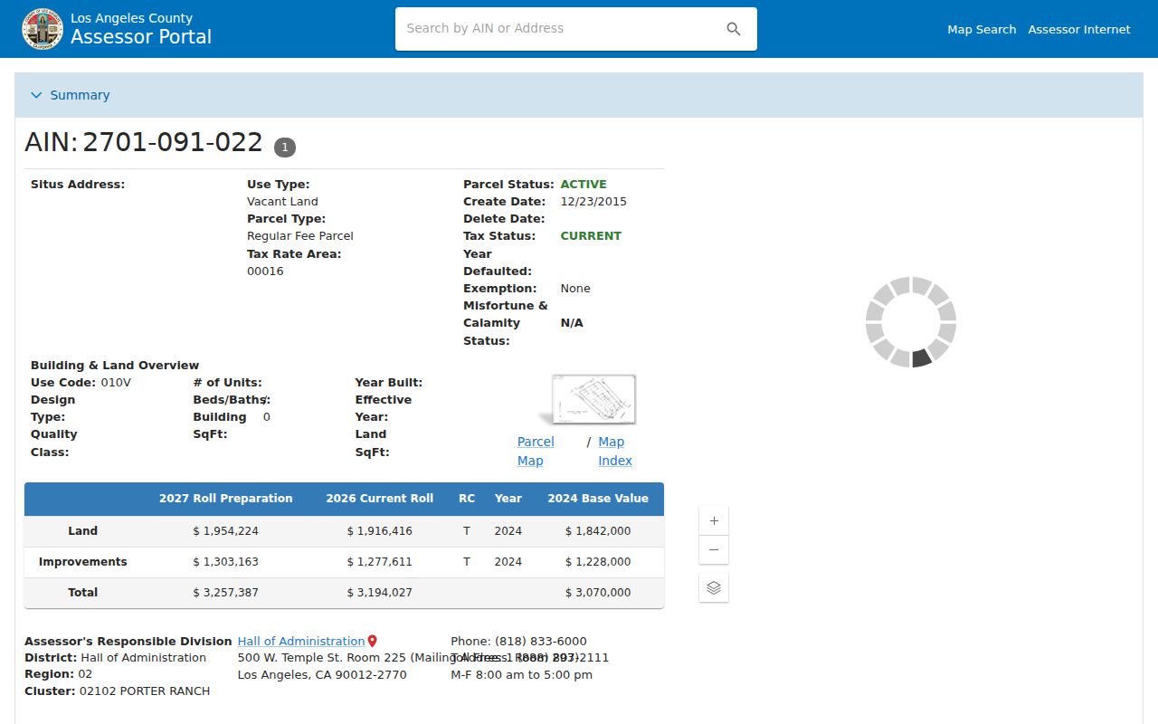
Those fields locate a parcel. They do not turn the parcel page into a household roster.
Browse Pasadena Street Blocks
The Los Angeles County Assessor map supports a block-level address trail by making neighboring AINs clickable. Locate the subject parcel by address or AIN, zoom to the block, click each adjacent polygon, and record its AIN and situs. Repeat the same parcel-detail step for each lot. The map supplies geography, not owner names.
Pasadena zoning and city-boundary context can be checked through the city’s planning and GIS resources. A neighboring polygon may sit across a municipal line or carry a mailing label that differs from the incorporated place. Record the city label and ZIP separately from the parcel’s physical situs.
- AIN
- The Assessor Identification Number assigned to a parcel in the county property system.
- Situs address
- The physical location enrolled for the parcel, which may differ from a mailing address.
- Plat or tract
- A mapped subdivision reference used to keep land continuity when street names shift.
- Parcel map
- An assessment map for orientation, not a legal survey of ownership boundaries.
- Criss-cross directory
- A historical street-order section that moves from an address to listed names in one publication year.
That vocabulary makes a by-address trail easier to audit. A click from one polygon to another is a geographic relationship, not a claim that the occupants know one another or share a record.
Pasadena Mailing Address Is Not Situs
Pasadena address research can contain five different keys: ZIP for postal routing, situs for physical location, mailing address for tax notices, AIN for the assessor database, and legal description for the land conveyed by a deed. A corner building can use one street for mail and another on a permit. A condominium can have a unit and a separate AIN. A trust can appear as a deed grantee. None of those differences should be collapsed into one phrase such as “where the resident lives.”
The owner mailing route is useful because it can produce a name to take to the county recorder. It is not occupancy proof. Non-owner occupants, relatives, lodgers, and protected people may not appear in a parcel or deed record. The address record should report what the source says, including whether the address is situs, mailing, business, project, or historical.
Pasadena's address validator at Public Works uses a required numeric Street Number field and a required Street Name autocomplete. Omit the direction and suffix while choosing the street name from the list, then submit Search. The tool accepts Pasadena parcels and explicitly excludes Altadena and Sierra Madre, which helps separate a city-limit question from a mailing label.
Note: A consistent AIN and legal description are stronger continuity clues than a street spelling that changes between address systems.
Pasadena Permit Records Add Dates
Pasadena’s Permit Center and Citizen Self Service search add address-keyed context to the record trail. Public searches can cover permits, plans, inspections, and code cases. Advanced mode is used for Public Works permits. An account is needed for applications and transactions, but the public search itself is advertised as open.
A permit result may name an applicant, agent, contractor, or project participant. That role is not a resident statement. Use the permit date and scope to explain a change to the building, then compare the result with directories, Sanborn maps, or census evidence. The city's online permit guidance separates public property research from account-based transactions. Older files and records outside the dynamic search can be requested from the relevant city department.
The Permit Center is at 175 N. Garfield Avenue, Pasadena, California 91101. Building and Safety is reached at 626-744-7601, general permits and inspections at 626-744-4200, and Code Compliance at 626-744-8633. A focused Pasadena Public Records Act request should name the address, department, date range, and record sought.
Pasadena Parcel-to-Deed Records
The Los Angeles County Registrar-Recorder/County Clerk keeps real-estate records dating to 1850 or 1851, but its index is not on the Internet. The index is organized by grantor or grantee name and recording year. It cannot search a Pasadena street or AIN directly. First obtain an owner clue through the assessor’s permitted offline route, then visit the Norwalk index.
- Write down the AIN, situs, tract or lot, and owner or mailing clue without changing the address label.
- Search the current person as grantee in the likely recording year and capture document title, number, date, grantor, grantee, and legal description.
- Search the prior grantor as a grantee in an earlier year, using the legal description to test continuity.
- Order the identified document through RR/CC when the deed image or certified copy is needed.
Records from 1851 to 1957 are reviewed on the lower level at 12400 Imperial Highway in Norwalk, while 1958 to the present is on the second floor. Staff procedure help is available at 800-201-8999, option 3. This is a name-and-year chain, not an address search box.
Pasadena Streets Set the Grid
Pasadena’s address system has a local logic. Fair Oaks Avenue and Colorado Boulevard form the zero axes. Streets crossing Fair Oaks use east or west, while streets crossing Colorado use north or south. The municipal code allocates 12.5 frontage feet per number, with odd numbers on the northerly or westerly side and even numbers on the southerly or easterly side where the layout permits.
Direction is therefore a search field, not decoration. Leaving out north, south, east, or west can send an address search to a different parcel. The city’s address ordinance also covers official address assignment before construction, additions, or alterations, including apartment and unit numbers.
The Pasadena address-numbering ordinance is the source for the municipal address rules.
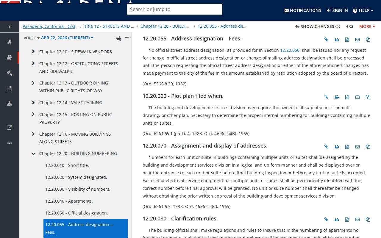
The ordinance view explains why a precise direction and unit label make a Pasadena address result more useful than a shortened street name.
Pasadena Criss-Cross Directories Recall Streets
Modern parcel tools own the current street angle. Historical city directories supply the older address layer. Pasadena Public Library directories go back to 1880, and the Pasadena Museum of History reports a near-complete 1893 to 1976 run. Street sections, reverse directories, spouse marks, occupations, and residence abbreviations can place a past household on a block even when the present parcel record contains no occupant name.
Read the volume key first. A mark such as r may mean residence or rooms, while h may mean householder or home, but the convention can vary by edition. Pair a directory with a census year, newspaper citation, Sanborn footprint, deed, or permit. A missing household may reflect a move, omission, different spelling, coverage boundary, or a street label that changed.
For a deeper historical shelf, use the Pasadena Directory Book collections. The address workflow remains the right place to connect that old clue back to a modern parcel, not to rebuild every collection record.
Pasadena Street Directory Limits
A Pasadena street directory cannot promise a complete list of residents. The public assessor site omits owner names with assessed values. The recorder has no Internet index and does not search by address. My Voter Status authenticates the requester’s own registration. A permit identifies a project role. A neighborhood or association page identifies a voluntary civic group, not its members.
Public records are also time-bound. A deed can be old. A mailing address can be remote. A directory can be out of date when it prints. A court or safety record can be sealed, redacted, or limited by rule. The right conclusion is narrow: a source associates a named person, parcel, project, or household with a place and date.
Privacy limit. Use Pasadena street records for lawful personal, family-history, preservation, civic, and property research. Do not use an address trail to stalk, harass, threaten, or harm anyone.
When a question shifts from one street to one person, use the separate resident lookup workflow and verify the record with its custodian. When it shifts backward through one house, use the previous-residents method and keep ownership, occupancy, and structure in separate columns.